These Secret Saugatuck Trails Will Make You Feel Like a Local (But Don’t Tell Anyone!)
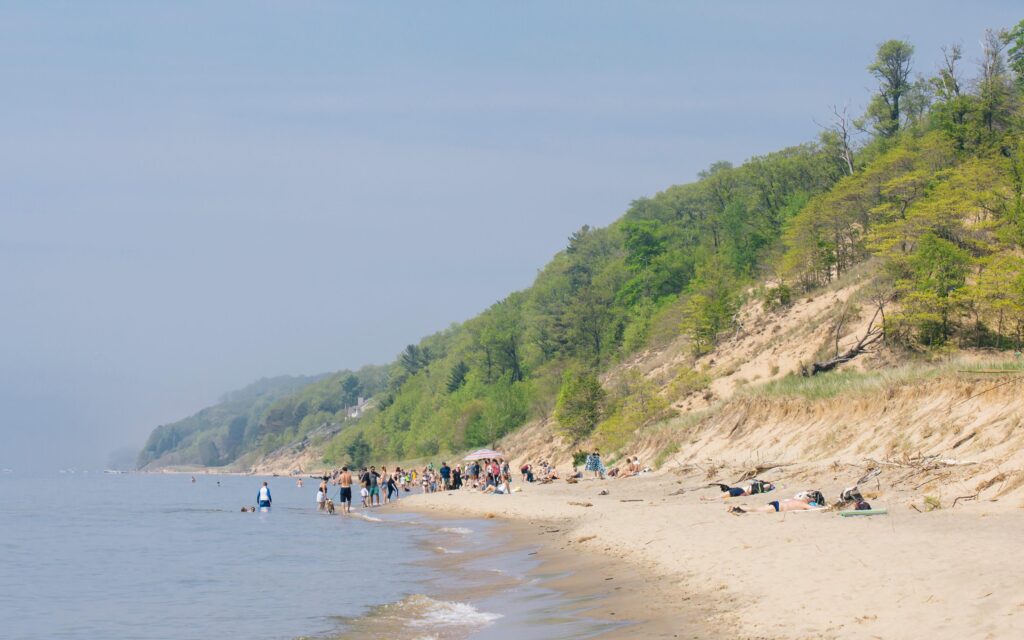
While tourists crowd Oval Beach and downtown galleries, Saugatuck’s true magic lies in its hidden network of trails that locals have been keeping under wraps for generations.
These aren’t your typical tourist paths, they’re the kind of secrets that get whispered over coffee at Uncommon Grounds, shared between long-time residents who’ve watched their beloved town transform into a bustling vacation destination.
The Forgotten Dunes of North Point
Remember those “No Trespassing” signs you’ve passed heading to Oval Beach?
Just beyond them lies the most spectacular hidden trail system in West Michigan. North Point’s unmarked paths wind through towering dunes and century-old beech trees, offering views that’ll make your Instagram followers think you’ve stumbled into a private paradise.
The best part? You’ll often have these trails entirely to yourself, especially if you time it right (hint: early mornings in mid-week are pure gold).
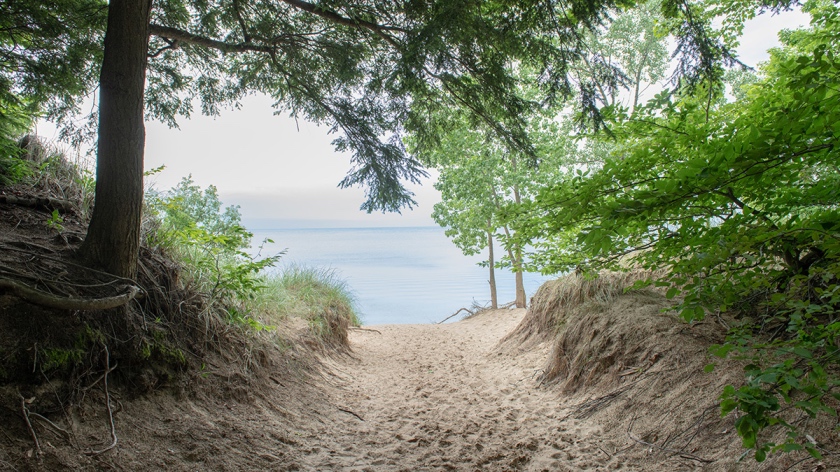
The trail starts innocently enough, a barely visible break in the dune grass that most people walk right past. But follow it for just five minutes, and you’ll understand why locals have kept this spot off the tourist maps.
The path climbs steadily through a series of rolling dunes, each one offering a more spectacular view than the last. About half a mile in, you’ll find what locals call “The Platform”, a natural plateau that serves as the perfect sunrise-watching spot. On clear mornings, you can see South Haven.
The Ghost Town Loop

Few visitors know that Saugatuck was built on the ruins of Singapore, Michigan’s most famous ghost town. A secret trail network, accessed through what looks like someone’s backyard (don’t worry, it’s public land), takes you through the remnants of this 1800s lumber town.
The path starts behind the old Harbor Duck building, marked only by a weather-worn post with faded yellow paint. Look for the hollow tree about 200 feet in – locals use it as a trail log to leave notes and hiking tips.
What makes this trail special isn’t just its history, it’s the way nature has reclaimed the old settlement. Sharp-eyed hikers might spot old foundation stones peeking through the moss, or pieces of ancient pottery after a good rain.
The trail loops around what used to be the town center, now a peaceful clearing where deer often gather in the early morning hours. Local legend says that on foggy mornings, you can still see the outline of the old lumber mill against the mist.
The Artist’s Way

This one’s special. Behind the Ox-Bow School of Art, a narrow dirt path disappears into what seems like an impenetrable brush. Push through (trust me), and you’ll discover why generations of artists have found inspiration here.
The trail opens to a series of natural amphitheaters carved into the dunes, each offering a different perspective of the Kalamazoo River.
Local painters call it “Nature’s Gallery,” and on quiet mornings, you might catch them setting up their easels in hidden corners.
The path itself feels like walking through a living art installation. Years of students have left subtle marks, a carved branch here, a carefully placed stone there.
Nothing intrusive, just gentle reminders that this is a place where creativity flows as naturally as the river below. The third amphitheater, known as “The Canvas,” is particularly special.
The way the light hits the water creates an ever-changing display of colors that local artists swear you won’t find anywhere else in Michigan.
The River’s Edge Secret

Here’s something the tourist maps won’t show you: a network of fishing paths that connect downtown to the old chain ferry dock.
These trails, maintained by local fishing enthusiasts, offer the best riverside views in town. Look for the gap in the fence behind the Saugatuck Center for the Arts, that’s your entry point.
The paths are marked by small blue stones (placed by a local artist who’s been maintaining these trails for 30 years).
These paths provide more than just scenic views, they’re living history. Old-timers say these trails haven’t changed much since the town’s early days when riverboat captains used them as navigation markers.
Today, they’re the perfect spot to watch the sunset or catch glimpses of river otters playing in the early morning hours. The best section, known as “Captain’s Corner,” offers a view of three bends in the river at once, a perspective you simply can’t get from any official viewpoint.
Local Tips That Make All The Difference

The best access points are often disguised as private property or dead ends. That narrow gap between the blue house and the pine grove on Water Street? That’s actually public access to the most scenic section of the Ghost Town Loop.
Time your visit with low tide to find the hidden beach that appears twice daily beneath the old ferry crossing.
Pack light but smart, these trails aren’t maintained like the tourist paths. Bring water, wear sturdy shoes, and maybe pack a small sketchbook. You never know when you’ll find a view that begs to be captured.
Most importantly, bring your phone for photos, but keep it tucked away most of the time. These trails are best experienced fully present.
Peak Times and Secret Spots
Most tourists hit the trails between 10 AM and 4 PM. Show up at 7 AM or during the golden hour before sunset, and you’ll see why locals guard these spots so fiercely.
The light filtering through the trees creates natural spotlights that turn ordinary forest scenes into something magical.
Winter mornings, when frost coats the beech trees, offer some of the most spectacular views, and you’ll likely have the trails entirely to yourself.
The Local’s Promise
When you find that hollow tree on the Ghost Town Loop, add your own note to the trail log. It’s how visitors become part of Saugatuck’s secret history, one hidden path at a time.
But remember, these trails stay special because those who know them understand their value. Share them selectively, treat them gently, and they’ll remain Saugatuck’s best-kept secrets for generations to come.